The short answer
- The Tablelands start about an hour from Cairns and sit 600 to 1,100 m above sea level, noticeably cooler.
- Two ways up: the Gillies Highway, 80 km to Atherton, or the Kuranda Range, 93 km.
- The Gillies has 263 corners and climbs 800 m in 19 km. Not for anyone who gets carsick.
- What's up there: waterfalls, two volcanic crater lakes, giant fig trees, platypus and dairy country.
- Doable as a day trip and much better on a tour if swimming is the point.
The Atherton Tablelands are the part of the Cairns region that most visitors miss and most locals go to on weekends. An hour inland the coastal plain lifts abruptly into a plateau of dairy farms, crater lakes and rainforest remnants, and the temperature drops with the altitude.
It's the antidote to the reef: green, cool, freshwater, and quiet.
What the Atherton Tablelands are
A volcanic plateau south-west of Cairns, sitting between roughly 600 and 1,100 metres above sea level. That altitude is the whole point, it makes the Tablelands several degrees cooler than the coast, which is why the area became dairy and coffee country, and why the crater lakes are cold enough to be refreshing rather than tepid.
The volcanic history is visible everywhere: two water-filled craters at Lake Eacham and Lake Barrine, the Mt Hypipamee crater, and rich red soil that grows everything from bananas to coffee to macadamias.
Quick picks
Three ways up the range, depending on what you want from the day.
- Best way to see itThe waterfall circuit day tour, four swims includedSee the day →
- Best with a familyBarefoot Tours Tablelands, child fares from age 8See the day →
- Best for the falls themselvesWhich ones you can swim inRead the guide →
On this page
How far is the Atherton Tablelands from Cairns?
| Route | To | Distance | Time | Character |
|---|---|---|---|---|
| Gillies Highway | Atherton | 80 km | 1 h 15 | 263 corners, 800 m climb in 19 km |
| Kuranda Range | Atherton | 93 km | 1 h 30 | Longer, gentler, via Kuranda and Mareeba |
| Kuranda Range | Mareeba | 61.6 km | ~1 h | The northern gateway |
| Palmerston Highway | Millaa Millaa | ~1 h 45 | 1 h 45 | The southern approach, via Innisfail |
The Gillies Highway starts at Gordonvale, 35 km south of Cairns.
The Gillies Highway is the direct route and it's a genuine mountain road: 263 corners, climbing 800 metres in 19 kilometres of tarmac. It's a fine drive in daylight in a car you know. It is not a good idea after dark, in heavy rain, or with anyone in the car who gets motion sick. Every waterfall tour we book uses it, and every guide has a story about someone who wishes they'd sat in the front.
The Kuranda Range road is 13 kilometres longer and considerably less dramatic, which for a lot of people is the better trade. It also lets you combine the Tablelands with Kuranda, though not in a way that leaves time for either, see our Kuranda guide for why that day deserves its own slot.
Don't drive the Gillies at night. It's unlit, the corners are tight, and there's genuine wildlife on it. If your plan involves being at a waterfall for sunset, plan to come down the Kuranda Range instead, or stay up there.
What to see on the Atherton Tablelands
The waterfalls
The main event. Millaa Millaa Falls is the famous one, with Zillie and Ellinjaa on the same 15 km loop. Josephine Falls, on the eastern edge, has a natural granite rock slide that is the single most fun thing to do up here. Babinda Boulders is spectacular and has a serious drowning history outside the designated area. Our waterfalls guide covers which ones you can swim in.
Lake Eacham and Lake Barrine
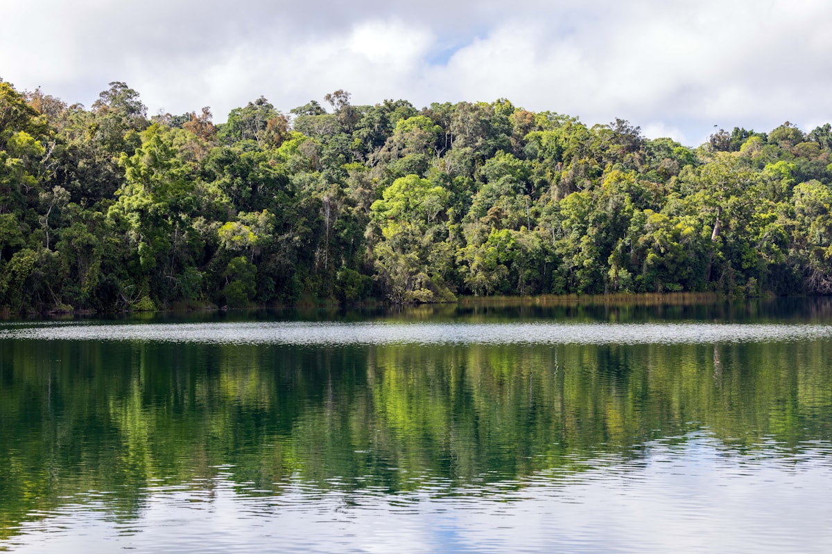
Two water-filled volcanic craters in rainforest. Lake Eacham has an easy entry and is the best swim on the Tablelands, warmer than the falls, with turtles. Lake Barrine has a walking circuit past kauri pines said to be around a thousand years old, and a tea house that does Devonshire tea, which is more charming than it sounds.
The fig trees
The Curtain Fig and the Cathedral Fig are both enormous strangler figs with boardwalks to them. Five minutes each, genuinely worth stopping for, and free.
Mt Hypipamee crater and Dinner Falls
A narrow volcanic pipe dropping to a green lake far below, with Dinner Falls on the same short walk. Quiet, and a good place to see tree kangaroos at dusk if you're lucky.
Granite Gorge
Rock wallabies that will eat out of your hand, and a granite creek to swim in. Popular with families, and a private reserve so there's an entry fee.
Coffee, chocolate and cheese
The Tablelands' agricultural side is a real part of the day: Coffee Works at Mareeba, dairy at Malanda, plus mango wineries and macadamia farms. This is why the gentler tours build a food stop into the itinerary.
Paronella Park
Technically just off the Tablelands proper, near Mena Creek. A 1930s Spanish-style castle and garden built around a waterfall, with the evening light show included in admission. Genuinely odd and genuinely good. See the Paronella day tour.
Wildlife on the Tablelands
This is the best wildlife country in the Cairns region, and it's not close.
- Platypus: Peterson Creek at Yungaburra and the Tarzali Lakes are the two reliable spots, and the season is roughly April to October. Dawn and dusk. Sit still and watch for the ripples.
- Tree kangaroos: Lumholtz's tree kangaroo lives up here and nowhere near the coast. Rare, but the Tablelands is where you'd have a chance.
- Rock wallabies: Granite Gorge, up close and unbothered.
- Cassowaries: more likely on the wetter eastern edge than on the farmland. Keep your distance; see our note on them in is Cairns safe.
- Birds: the Tablelands is a serious birding destination. Lake Barrine's circuit and the fig trees are the easy wins.
Note what isn't up here: estuarine crocodiles. This is non-tidal, high-altitude freshwater, which is exactly why the swimming holes are safe to swim in. The full picture is in crocodiles in Cairns.
The towns
None of them are destinations in themselves, but they shape the day:
- Mareeba: the northern gateway, an hour from Cairns via the Kuranda Range. Coffee, mangoes, and a drier, more open landscape.
- Atherton: the biggest town, 80 km from Cairns, and the practical centre if you're basing yourself up here.
- Yungaburra: the prettiest, a heritage village near Lake Eacham and the Curtain Fig, with the platypus creek running through it. If you stay one night on the Tablelands, stay here.
- Malanda: dairy country, and where the pub lunch on several tours happens.
- Millaa Millaa: a crossroads with the region's most famous waterfall two minutes away.
- Herberton: an old tin-mining town with a large historic village attraction.
Tour or self-drive?
Different answer from the Daintree, because the driving up here is harder but the distances are shorter.
| Guided day tour | Self-drive | |
|---|---|---|
| Cost per adult | $169–$219 including lunch and park fees | Car hire and fuel |
| The Gillies Highway | Someone else drives its 263 corners | You drive them, twice |
| Swimming | Four stops on a circuit day, guide knows conditions | You choose, but check closures yourself |
| Food | Included on most tours | Malanda, Yungaburra or a picnic |
| Flexibility | Fixed circuit | Total, and there's a lot up here |
| Best for | One day, swimming-focused, no car | Two days, birding, food, staying overnight |
Honest position: for a single day with swimming as the point, take the tour. The circuit is about 300 km with four swims in it, and doing that yourself means being the designated driver on a mountain road after a day in cold water. Uncle Brian's at $199 is the highest-rated version and it's adults-only, 18+. Barefoot at $169 adult and $149 child takes families from age 8.
Self-drive if you have two days, want to be at a fig tree at dawn, or care about the food and birding side. Stay at Yungaburra.
One day, four swims, someone else on the corners
The Tablelands circuit takes in Josephine Falls' rock slide, Babinda Boulders, Millaa Millaa and a crater-lake swim, with park fees and lunch included.
See the waterfall day →Best time to go up the range
The Tablelands invert the coastal calendar, and it's worth knowing.
- May to July is the sweet spot: still plenty of water in the falls from the wet season, clear skies, comfortable walking temperatures, everything open.
- January to April gives maximum waterfall volume and the most electric green, but swimming holes close on high flow and Josephine's rock slide shuts when the river is up.
- August to November is lowest flow. Millaa Millaa still looks good; the smaller falls thin out. Water is clearest and warmest for swimming.
- Platypus season is roughly April to October, which pulls the ideal window towards mid-year.
And remember the altitude: it can be 8 to 10 degrees cooler up here than on the Esplanade. Take a layer, particularly for an early start. The coastal numbers are all in our Cairns weather by month guide.
How we know this
We're based in Cairns and we book the Tablelands day tours, so we know which circuits swim and which sightsee. Road distances and the Gillies Highway detail come from published Tablelands travel information; every tour itinerary and price came from the operator's own material.
Waterfall access closes on high flow and after heavy rain. Swimming holes are unpatrolled, obey closure signs.
The Atherton Tablelands: our verdict
Go, and give it a full day. It's the part of the region visitors skip and locals use, and at 600 to 1,100 m it's the one place near Cairns where you'll want a layer. If swimming is the point, take a guided circuit: 300 km and 263 corners is a lot to drive yourself after four cold swims. If you have two days, self-drive and stay at Yungaburra for the platypus and the fig trees at dawn. Aim for May to July.